 العربية


Description
OKM GEPARD GPR 3D
The Gepard GPR is a very flexible and powerful Ground Penetrating Radar for the detection of underground objects like pipelines, cavities, cables, conduits, tunnels, bunkers, and foundations.

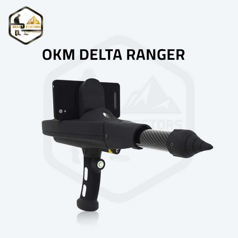
The Gepard ground penetrating radar uses an omnidirectional unshielded transmission system to reach maximum depths up to 40 meters (131 ft). The agile and compact unit can easily be operated by a single user via Android Tablet PC.
The RADAR (Radio Detection and Ranging) of the Gepard GPR 3D sends a signal into the ground and awaits the reflection or echo of the signal to detect sub-surface anomalies.
WATCH THE OKM GEPARD GPR 3D VIDEO HERE!

DETECTABLE OBJECTS AND STRUCTURES
Underground walls, basements, and concrete reinforcements
Hidden cavities, graves, and sepulchers
Water level and underground rivers and aquifers
Buried pipelines, conduits, and cable harnesses
Backfilled wells, galleries, trenches, and dugouts
Septic tanks, distribution boxes, and drainage pipes
Secret tunnels, bunkers, and shelters
Buried treasure chests, statues, and caches
OPTIMIZATION OF GROUND SURVEY
The Gepard ground penetrating radar is using multiple transmission frequency ranges starting at 60 MHz up to 300 MHz which is realized by adjustable telescopic antennas. It furthermore supports many automatic adjustments to optimize your ground surveys on specific soil types, which makes the handling of the Gepard ground radar very easy. You just set your depth resolution and start surveying.
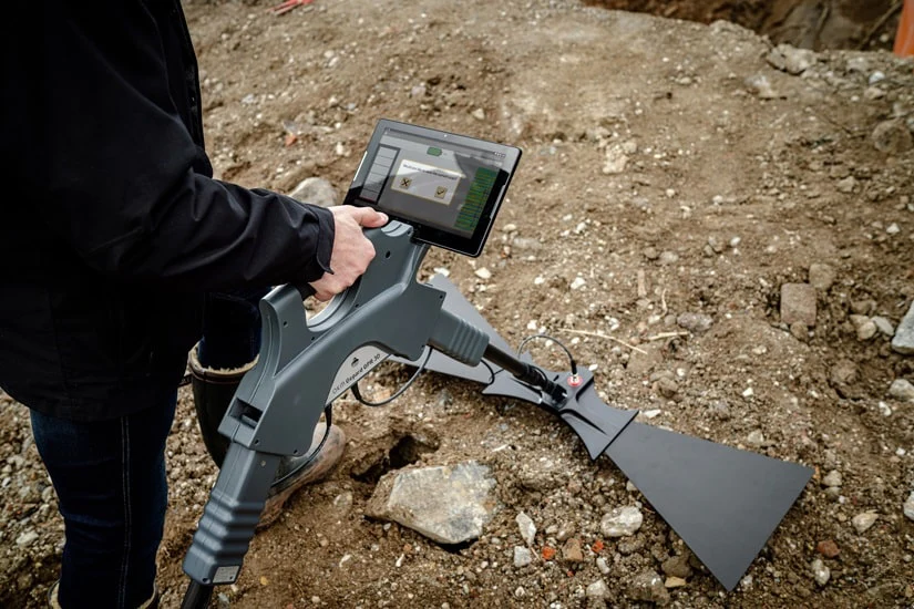
MEASUREMENT DATA ANALYSIS WITH ANDROID SOFTWARE
The measured data of the ground-penetrating radar is immediately transferred to the Android Tablet PC. The Android software receives the data via WiFi and displays it directly on the screen.
The software offers the option of integrating a GPS signal or Google Maps, filtering automatically, and entering notes for later recollection of specific scan details. Additionally, the automatic filtering option improves the results of your scan and assists in finding hidden objects and structures more easily. Due to the integrated GPS, all scan positions can be stored along with the scan data.
The RADAR (Radio Detection and Ranging) of the Gerard GPR 3D sends a signal
into the ground and awaits the reflection or echo of the signal to detect sub-surface anomalies.
This technology uses a multiple transmission frequency range starting at 60 MHz
up to 300 MHz which is realized by adjustable telescopic antennas.
Also The device supports many automatic adjustments to optimize ground scans
on specific soil types such as rocky or sandy soils, which makes the handling of the Gepard ground radar very easy.
So the user just set required depth resolution and start the scan process easily.
| Technical Specification Name | Technical Specification Value |
| CONTROL UNIT | |
| Dimensions (H x W x D) | 450 x 260 x 130 mm |
| Weight | approx. 1.6 kg |
| Input voltage (max.) | 8.4 V DC / 1.0 A |
| Operating temperature | –20°C – 55°C |
| Storage temperature | –25°C – 60°C |
| Waterproof | No |
| Operating time | approx. 4 hours |
| Air humidity | 5% – 70% |
| Feedback | acoustic, visual |
| Protection Type | IP 20 |
| Data Transmission Technology | WiFi, 2.4 GHz |
| Transmission Frequency Range | 60 – 300 MHz |
| Timing/Sampling Adjustments | 4 Levels |
| Complete Cycle Measurements | 9 per second |
| TELESCOPIC SHAFT | |
| Dimensions (H x W x D) | 70 x 60 x 590–1630 mm |
| Weight | 0.80 kg |
| Operating temperature | –20°C – 55°C |
| Storage temperature | –25°C – 60°C |
| Waterproof | No |
| Air humidity | 5% – 70% |
| Protection Type | IP 20 |
| Internal Battery | 7.26 V / 2600 mAh |
| TRIANGULAR ANTENNA (UNSHIELDED) | |
| Dimensions (H x W x D) | 1010 x 330 x 50 mm |
| Weight | 1.50 kg |
| Operating temperature | –20°C – 55°C |
| Storage temperature | –25°C – 60°C |
| Waterproof | No |
| Air humidity | 5% – 70% |
| Protection Type | IP 20 |
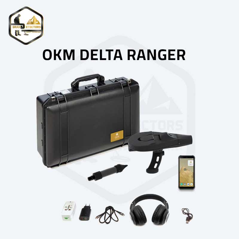
- Control unit
- GPR receiving unit with 2 triangular antennas
- GPR transmitting unit with 2 triangular antennas
- Telescopic shaft
- Android Tablet PC
- Waterproof and shock resistant Pelican case
- Bluetooth headphones
- Charging adapter and power supply
- Travel adapter
- User’s manual